


Photogrammetry & Theodolite Antenna Alignment Services
-
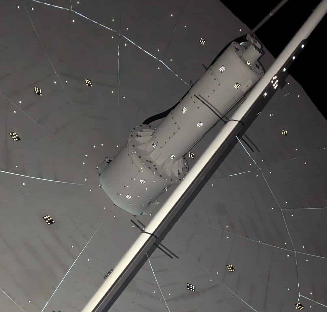
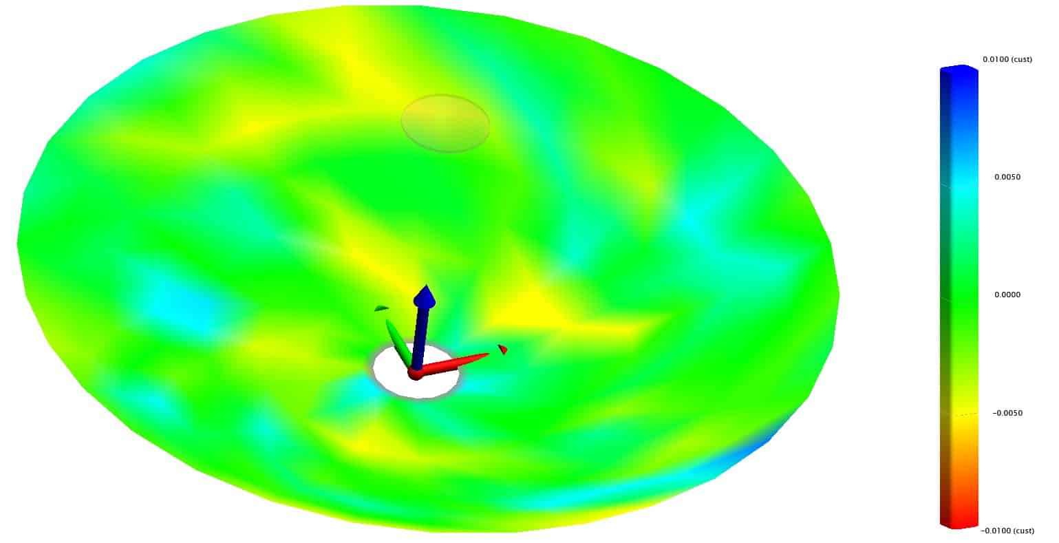
Photogrammetry Analysis for Satellite Ground Stations
Our Alignment & Photogrammetry Services include the equipment and expertise to provide traditional theodolite and modern advanced photogrammetry analysis. Our Field & Engineering Teams have been trained in the operation of our specialist photogrammetry kit, complete with in-house software. This means our technicians can run field tests and swiftly analyse results back at the lab without any delays or out-of-pocket costs associated with waiting for third-party involvement.
Degradation of system performance over time is particularly relevant to critical assets that make up parts of emergency backup systems, remote networks, and more. Regular photogrammetry ensures your antenna system continues to perform to the necessary level, affirming satellite’s place in your backhaul or emergency redundancy system.
-
Theodolite Alignment for Antenna Reflectors
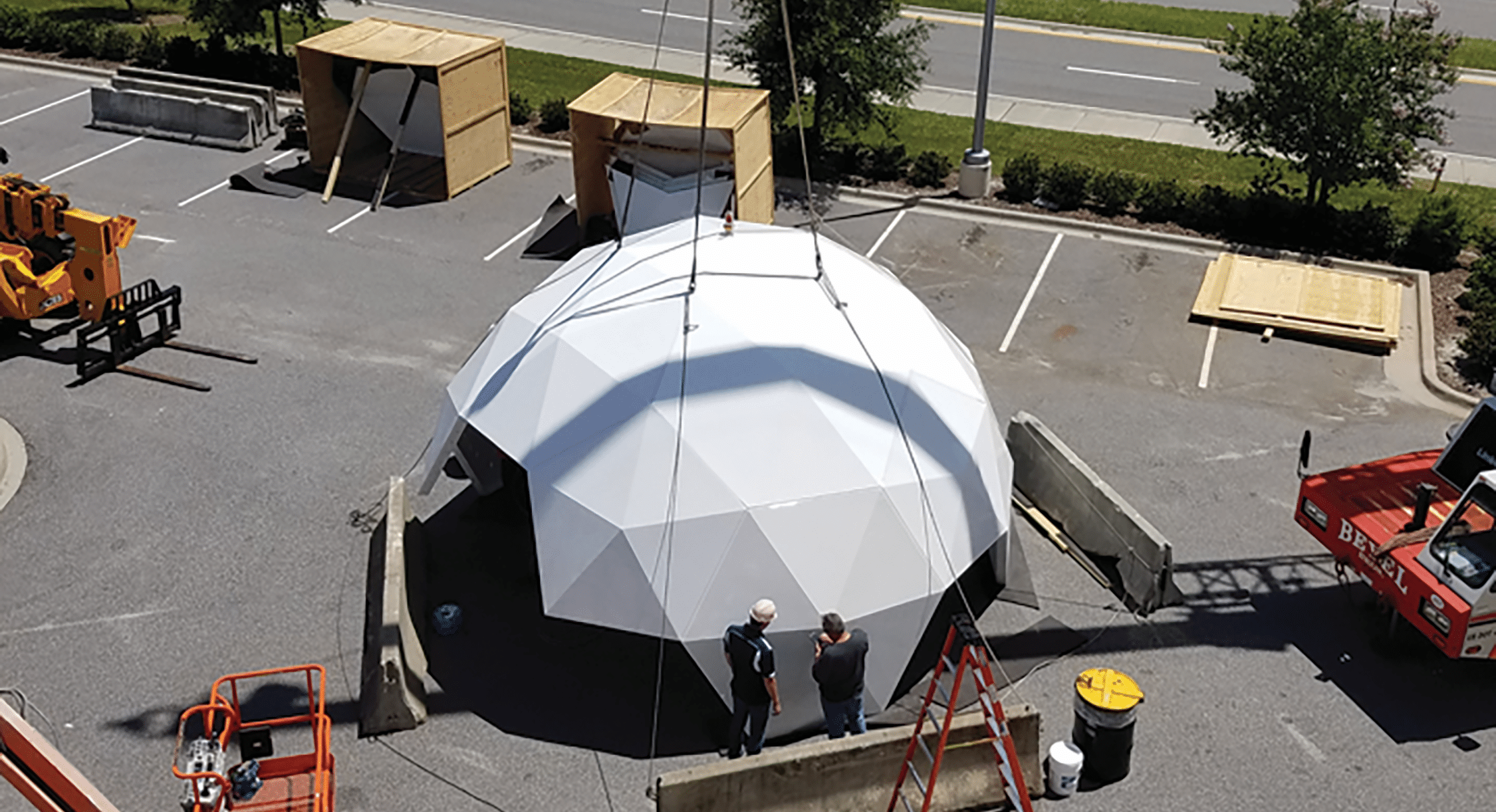
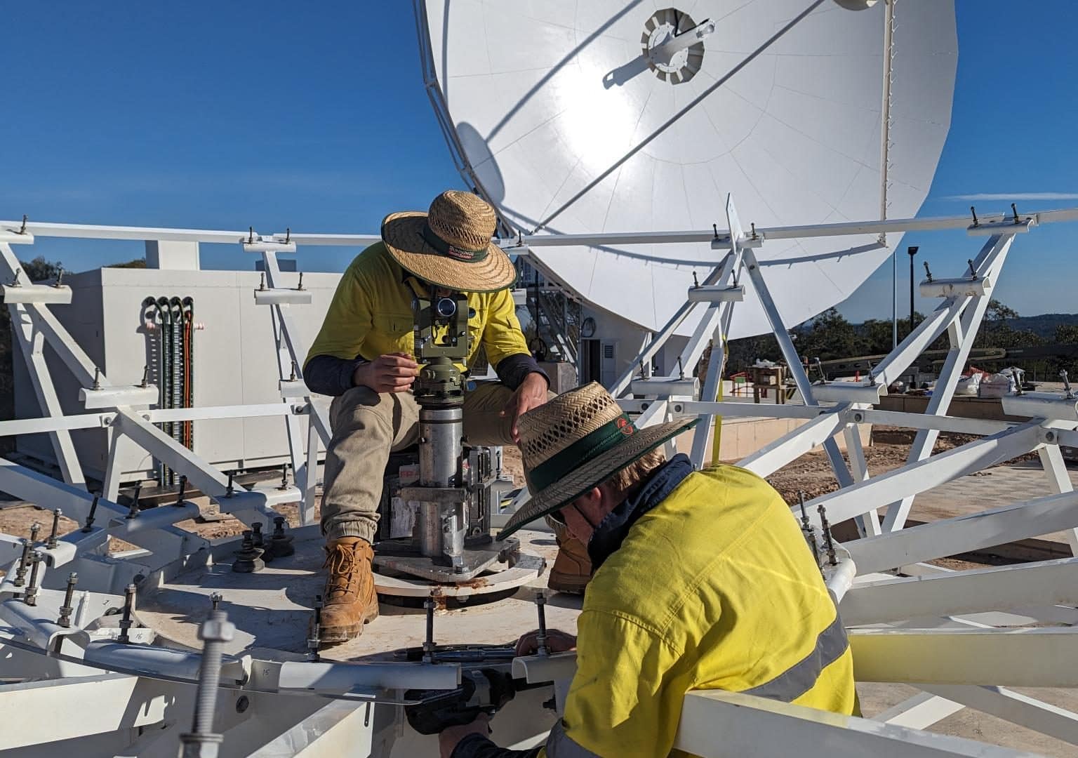
Traditional analysis of a satellite ground station antenna’s shape is done using a theodolite. The technology is not as technically advanced or accurate as photogrammetry but is still used for satellite ground stations using frequency bands lower Ku Band and lower, typically in the 2-14GHz range. This is largely because the accuracy of the antenna reflector shape at these frequency bands does not require the additional accuracy of photogrammetry technology. Theodolite analysis is typically only conducted during assembly of a satellite ground station’s reflector as it requires bolting the theodolite to the reflector to conduct the analysis. Theodolites are not as flexible as photogrammetry tools to verify and validate existing satellite ground station antenna structures.
-
Upgrade & Re-Band your Satellite Ground Station
The capability afforded to our engineering team by the use of photogrammetry allow us to help our customer by repurposing their legacy antennas that previously would have been decommissioned at the end of their operational lifespans. Old dishes are now able to be expertly re-banded by Av-Comm, providing a more cost and time efficient alternative than replacing the system with a new satellite ground station.
Once a complex digital model of your antenna has been created, structural flaws and uneven surfaces can be easily identified. Av-Comm’s technicians can then update and refresh your antenna to suit new frequency requirements, enhancing antenna gain and realigning the reflector to a nominal position, allowing our customers to extract the maximum value from their antenna systems.


Enhancing Your Satellite Ground Station with Precision and Detail

Enhanced your Ground Stations Accuracy
Photogrammetry provides highly accurate 3D models, ensuring precise alignment and calibration of satellite antennas. This leads to improved signal quality and reliability.
Cost Savings
By reducing the need for physical inspections and manual measurements, photogrammetry saves time and labor costs, while minimising the risk of human error.
Efficient Planning and Maintenance
Detailed 3D models help in planning and maintaining ground station infrastructure. They allow for better visualisation of the site, making it easier to identify potential issues and plan upgrades or repairs.
Disaster Preparedness and Recovery
Detailed 3D models are invaluable for disaster recovery planning. They enable quick assessment of damage and efficient planning of repairs, minimising downtime and ensuring continuity of operations.
Why choose Av-Comm for these Services?
Expertise in the field
Our team of skilled professionals has extensive experience in photogrammetry and satellite ground station operations.
Enhanced Reliability and accuracy
High precision and detail in every satellite ground station we work on. Therefore, allowing you to communicate to your satellite effectively.
Most advanced technology
We use the latest software and hardware to ensure the highest quality results.
Customisation and Support
We provide comprehensive support from project inception to completion, offering tailored solutions to meet the specific needs of your ground station.
-
 We couldn’t be happier with Av-Comm team members onsite for our first installation in Australia. The team were more than punctual each day and ready to get after the day sunup and sundown… Av-Comm has set the standard for installations and support with our antenna systems.Senior Director – Intellian
 -
Av-Comm have continually proven to be a highly capable supplier. Lockheed Martin values our business partnership with Av-Comm on both SouthPAN and Defence’s Satellite Communications programs.Warren McDonald – Chief Executive Officer – Lockheed Martin Australia and New Zealand
-
Working with Av-Comm has been a fantastic experience. Their commitment to excellence and customer satisfaction is evident in everything they do. I highly recommend Av-Comm Space and Defence to anyone in need of reliable and innovative ground satellite communication solutions.EM Solutions – John Logan – Vice President
-
“Another awesome result from the Av-Comm team. Improving Telikom PNG’s core infrastructure of national importance”Telikom PNG
-
“Thank you to the Av-Comm team for delivering this project. Another milestone achieved in helping Telikom PNG improve our network experience.”Telikom PNG
-
“Thanks for preparing this report… If you could, please consider sharing the relevant parts of the Lessons Learned with CPI for applying to future projects. Appreciate Av-Comm’s outstanding support throughout this installation.”Communications & Power Industries (CPI)
Trusted by Global Industry-Leading Brands